Leaving Yosemite Valley, the road heads south towards Wawona, passing forests subject to recent fires. Taking the road east towards Glacier Point, we arrive (30 miles by road from our camp) less than one mile (as the crow flies), and 3,400 feet above the Valley Floor. Glacier point offers views of the whole valley.
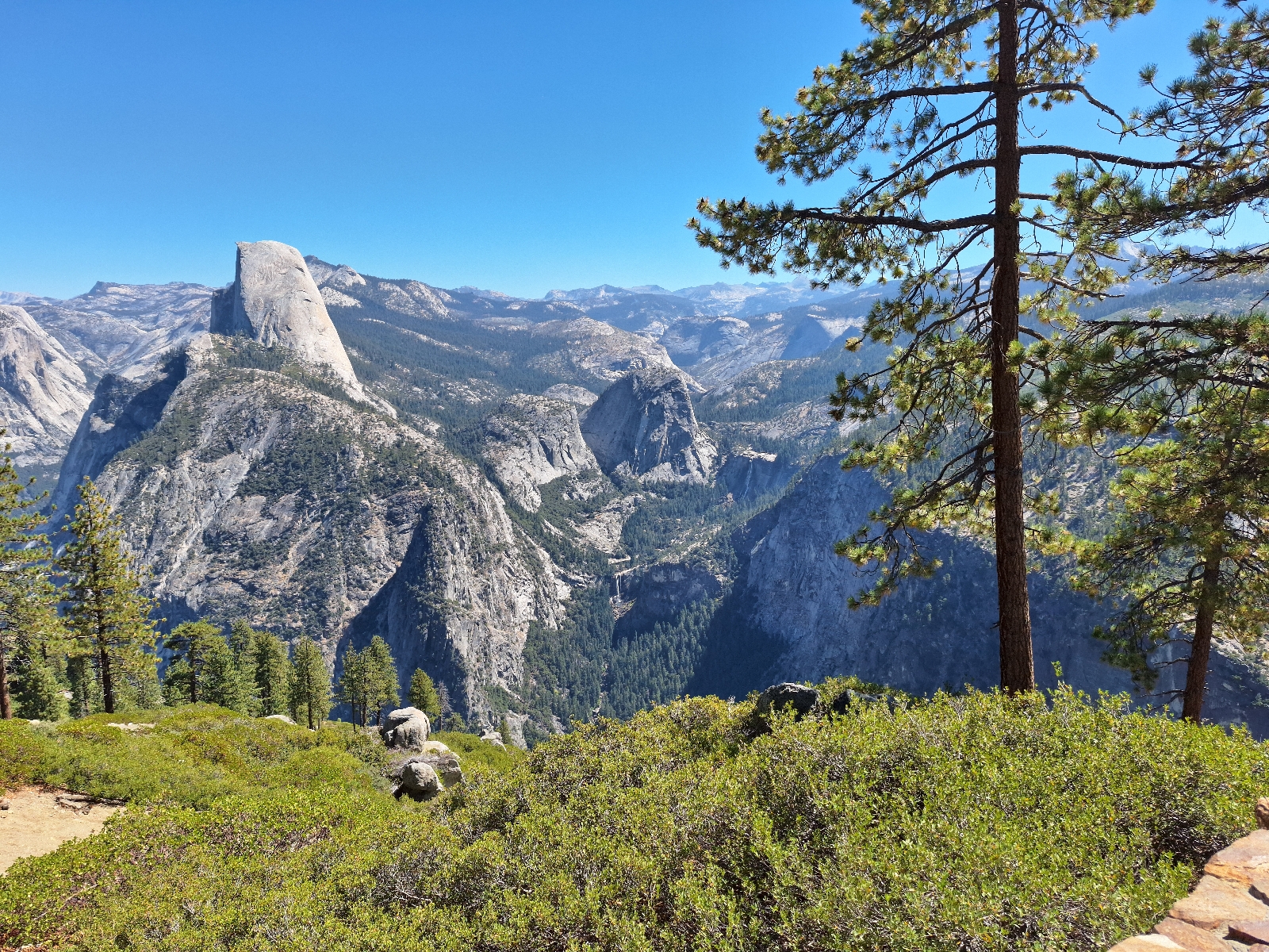
Driving back to the Sentinel Dome Trailhead, we set off on a short hike to Sentinel Dome. The short hike (1.25 miles one way) offers a gentle grade until the last 2/10 of a mile, when the trail goes up the east side of the dome. The views here were breathtaking in all directions. The grandeur of the valley unfolds below. In the east is visible the small remaining snow pack feeding the Merced river, flowing over Nevada Falls. In the center lies the flat-bottomed river valley surrounded by cliffs. To the West is the outlet of the river from Yosemite. With only a 450 foot elevation gain over 2.5 miles (round trip) hike, Sentinel Dome offers an exceptional view to effort ratio.
Wawona, near the south end of the Park was our destination for the evening. We stayed at the Wawona Hotel, the second oldest hotel in California.
 Yosemite Valley from tunnel view


 El Capitan

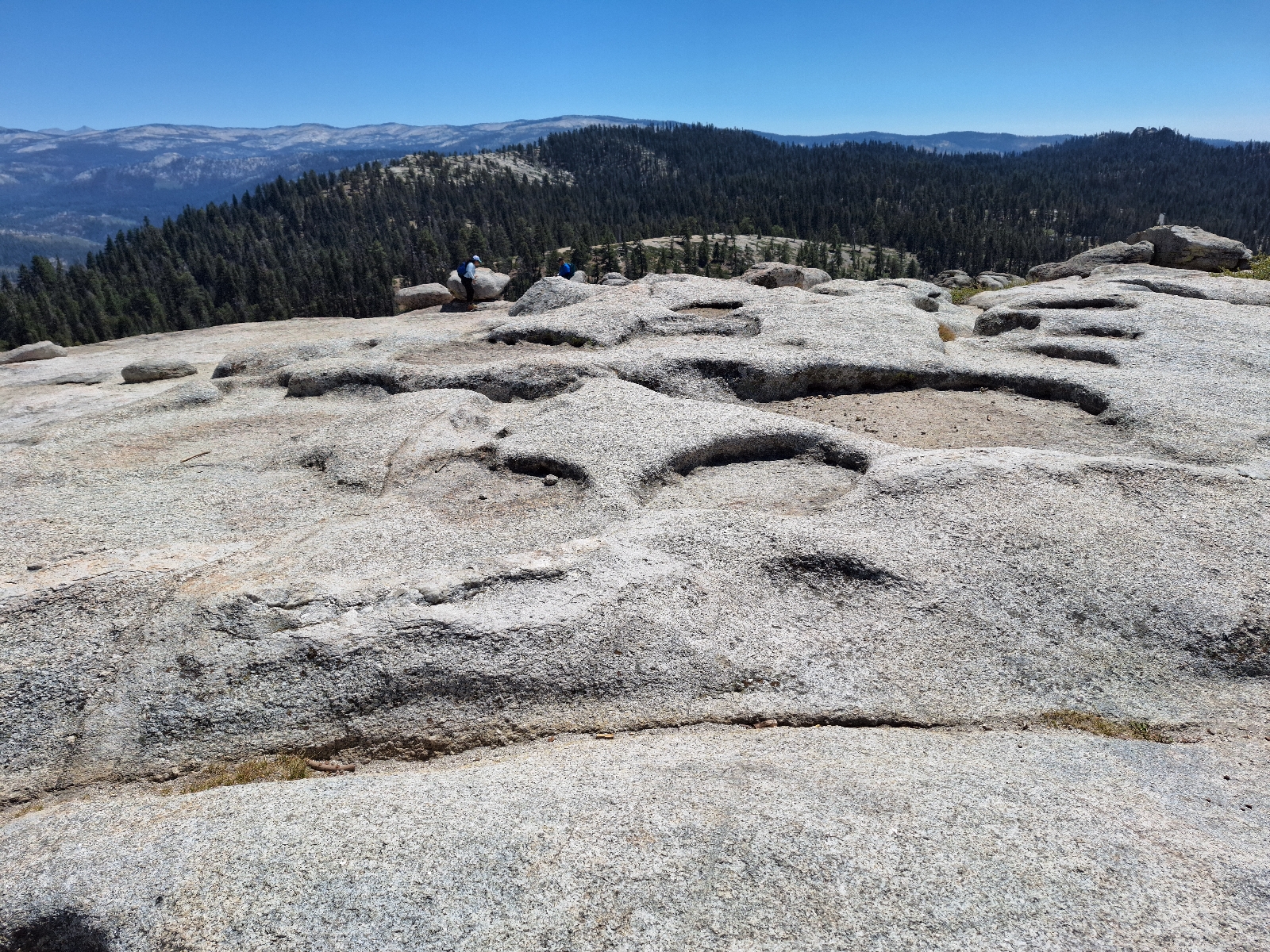 At the Dome summit


 Nevada Falls, far below


Creative destruction; fire opens the forest floor to sunlight, allowing new trees to sprout.
Views from Glacier Point
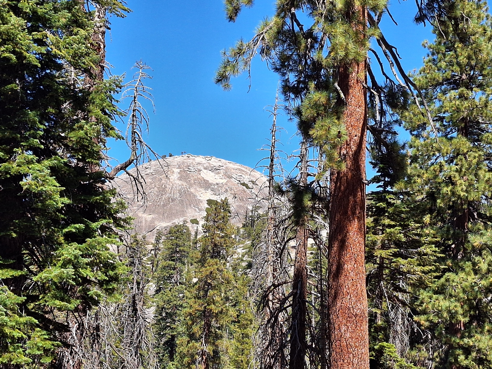
On the trail to Sentinel Dome, visible in the near distance
View of the outlet of the Merced River from Yosemite Valley


Dry Yosemite Falls

View east up the Yosemite Valley

Snow pack feeding the Merced River


Detail of Striations on Half Dome

Descending the trail
No comments:
Post a Comment