On a ridge east about 600 feet above Skagway lies lower Dewey Lake. The climb up from town is popular with cruise passengers visiting Skagway. The loop around the lake goes up and down, leading to a swimming spot, where the town has left a canoe and kayak for the public to enjoy. The 3.5 mile hike was a great way to spend our first morning in Alaska.
Skagway was the gateway to the Klondike for prospectors during the gold rush of 1897 to 1900. A railway was built ftom the port at Skagway up to the headwaters of the Yukon River at White Pass. Built in 2 years, 2 months, and 2 days, the three-foot guage railway opened in 1902.
The railway climbs 2,888 feet to White Pass in about 20 miles, and the tracks continue into BC and the Yukon Territory. To make the climb, the tracks hug the valley walls, crossing the river multiple times.
At the summit is the US/Canada border marker (1), followed shortly by the weigh station the Northwest Mounted Police used to ensure all prospectors had sufficient supplies for at least a year (2).
(1) No immigration procedures; the officials know the train will soon turn around and return to Skagway (a).
(a) Some trains continue further into Canada, but these have been disrupted by the mudslide also.
(2) The BC/American border was ill-defined at the time of the gold rush, accounting for the different placement of the border marker and the weigh station. The original 1825 Treaty of Saint Peterburg, between the Russian (b) and British Empires, was signed by people whose knowledge of the region's geography was sketchy at best. The boundary line on the Alaska panhandle agreed was the high point of the mountains running parallel to the coast, unless the high point was more than 10 leagues from the coast (about 35 miles), in which case the border would run 10 leagues from the coast (c) (d). The US and Canadian/British governments agreed to an arbitration panel in 1903, which demarkated the current borders
(b) Russia sold its interest in Alaska (i) to the US in 1867, in what at the time was called Seward's Folly, after the Secreraty of State who purchased the presumably worthless tundra.
(i) The native word for the place was transliteration into Russian as
(c) The Northwest Mounted Police sent officers to Skagway at the start of the hold rush. They argued that "the coast" should not include narrow inlets and therfore Skagway was British territory. They were soon expelled by American prospectors.
(d) Near Skagway, the height of land is close to the coast, and the boundary is therefore at the height of land, White's Pass. Near Haines, the height of land (Haines Highway Summit in BC) is about 55 miles inland, so the border here is 35 miles (as the crow flies, about 40 miles by road) from the tidewater at Haines.
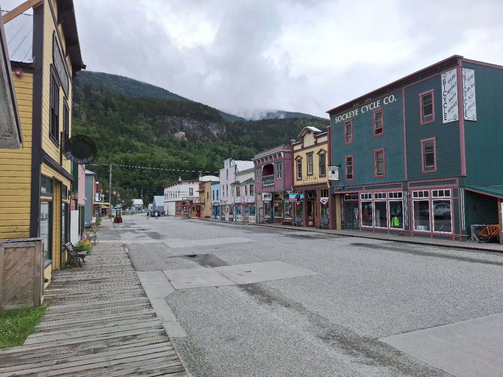
Walking through Skagway


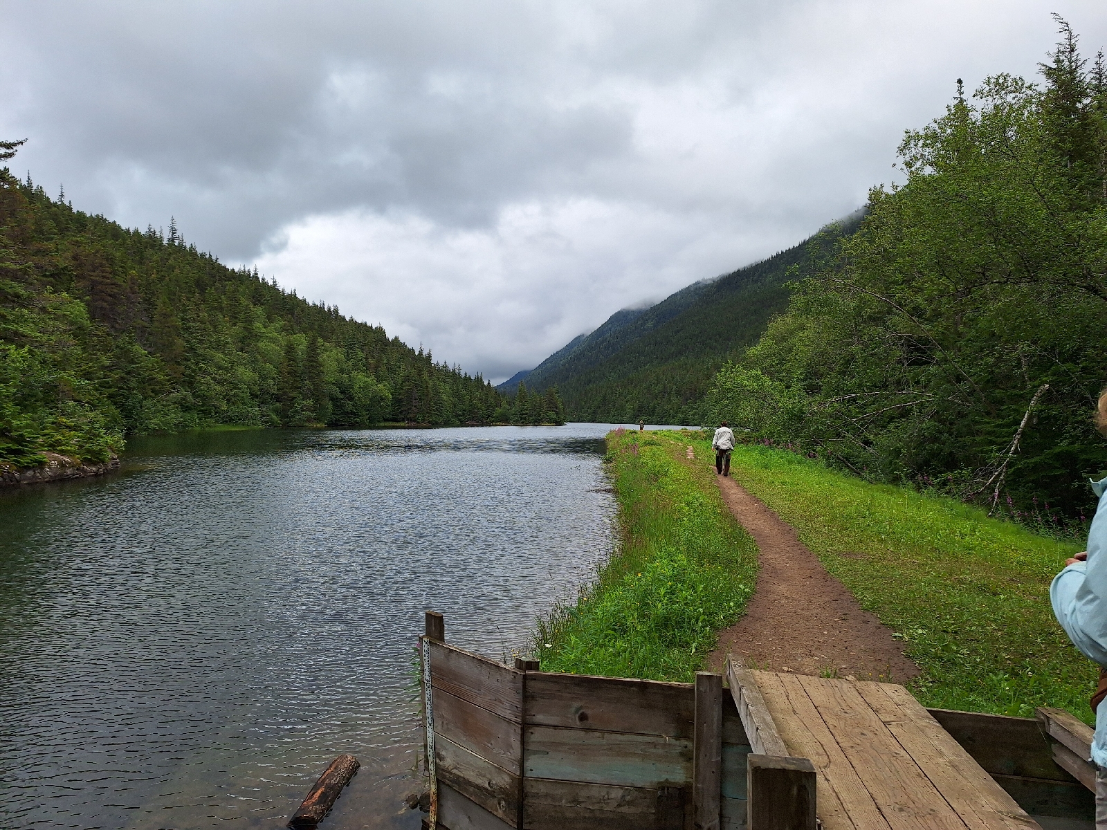

Lower Dewey Lake


North end of the lake


Boarding at Skagway

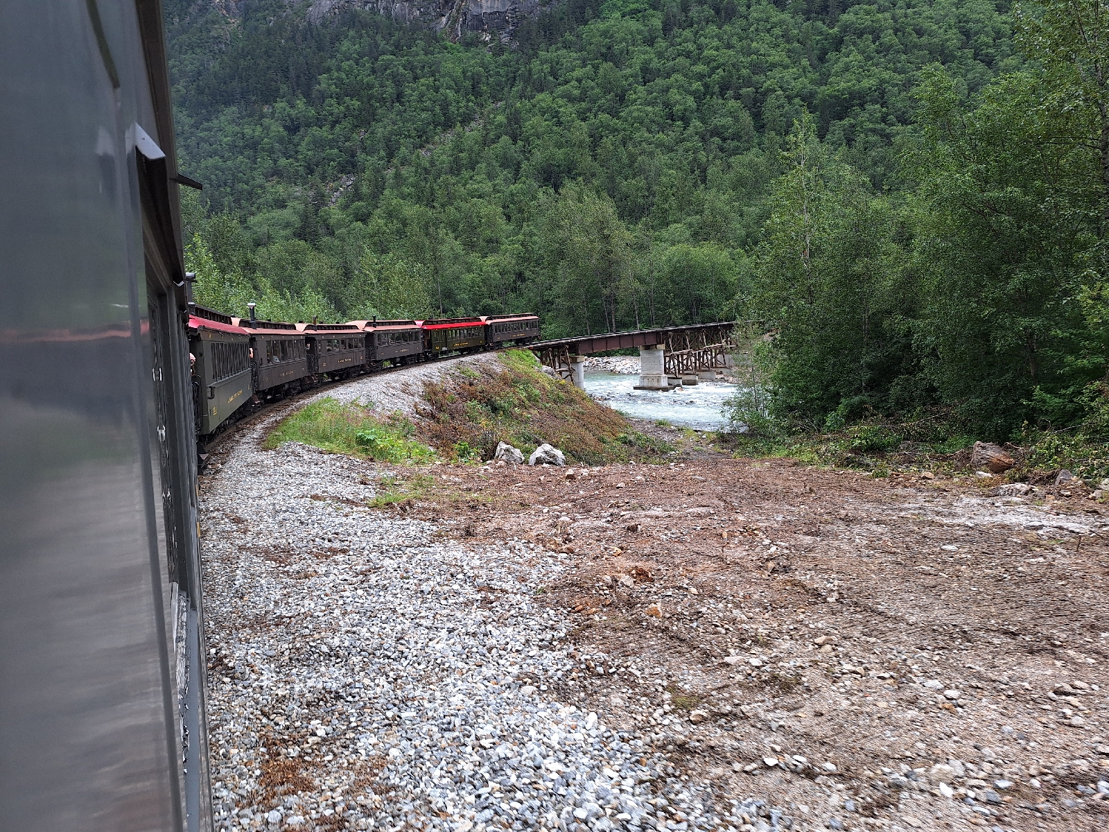
First crossing of the Skagway River at Denver


Second river crossing
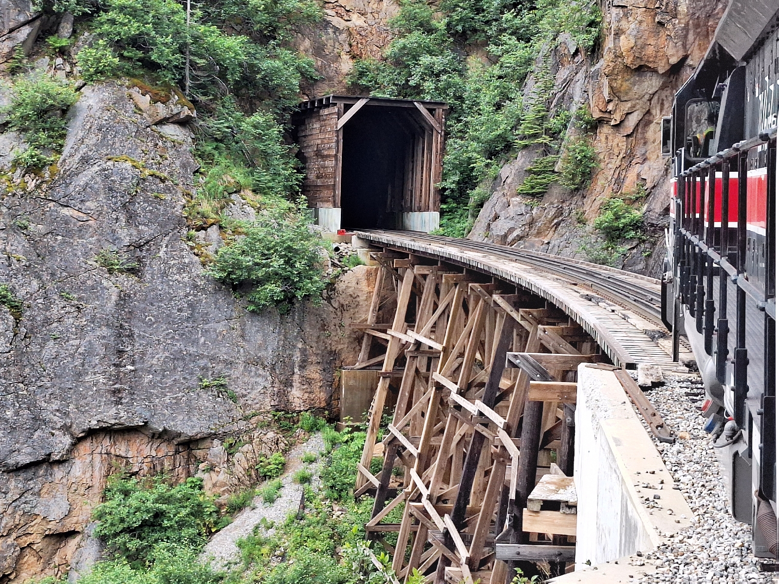
Approaching trestle

Almost in the clouds

View down to White Pass trail

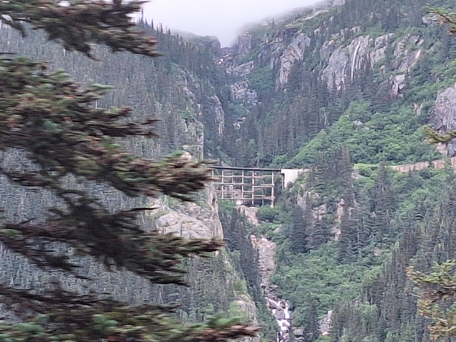
"Ghost bridge." The railway was realigned in 1969

Into Canada, but not for long

Weighing station for prospectors

Distant view to Skagway

Crossing the trestle


The trestle far above

Old caboose, now a hikers' shelter at Denver flag stop
No comments:
Post a Comment