Wednesday, August 24, 2022

Tram de Mont Blanc

August 24, 2022

A flight from Nice to Geneva cost only $28, so we headed north. The flight on this clear day provided grand views of the steep French Alps, which explains why there is no rail line connecting the two cities. 

A joint Swiss-French train goes direct from Geneva to the end of the standard guage railway line at St Gervais les Bains-La Fayet (1). Here a connection is made to the Tram de Mont Blanc (2), a steep, meter guage cog- rail tram which wanders through the streets of La Fayet before climbing from 580 meters at La Fayet to a point near the glaciers on Mont Blanc (called Aguille de Midi) at 2,386 meters. 

The Anne tram took us up as we enjoyed a seat directly at the front of the train. Return trams were scheduled to depart in an hour or in 3 1/2 hours. We wandered over to the small café for some caffeine and a closer look at the glaciers and returned on the Marie tram an hour later. Back in La Fayet, we dined outside while enjoying a fine view of the fading light on Mont Blanc.

(1) The station is in the town of La Fayet, but also serves the hill-side spa town of St Gervais Las Bains (The baths).

(2) The three tram sets are Anne (green), Marie (dark red), and Jeanne (blue), named after the original manager's three daughters  Modern replacements are arriving this year and are accord with the original design esthetic.
Flying over the Alps
The Mont Blanc tram station
Anne in the streets of La Fayet
Climbing Mont Blanc. Note the good maintenance of the railbed. The tram carries skiers in winter, although it ends at a lower altitude to limit avalanche risk.
Approaching the Glaciers
Glaciers on Mont Blanc
At the tram summit
View from descent
Nightfall in Mont Blanc view from La Fayet


Tuesday, August 23, 2022

Col de Boiselle/Colle de Bosellia

August 23, 2022

The Nice region was part of the Kingdom of Savoy until the mid 1800s (1) and a portion of the Alpes Maritimes northeast of Nice in the Roya River Valley remained part of Italy until 1947. The valley is therefore served by French trains from Nice and Italian trains from Ventimiglia on the Italian coast (2).

The train from Nice follows the historic mule trail (3) up the Paillon River Valley. The morning departure had commentary in French and English (4) from a bilingual guide who described the route and its history. While the railway was built in the steel era, the railway's designer preferred stone (5) and cement, both abundant in the region.

At Breuil sur Roya, the Italian line joins the French railway, and they share tracks from there to Tende, the last stop before the Italian border. The railway guide stopped to chat with us and enquire where we were headed:

"To hike between La Brigue and Tende" (7).

"There are two routes" she said.

"We're going via the Col de Boiselle" we replied.

She eyed the hiking boots we were wearing, and expressed her approval.

After alighting at La Brigue, we headed to town for provisions of bread and cheese, and found the well-marked trailhead toward the Col de Loubaira (6). The hike up offered little shade, but fine views back to La Brigue and to St Dalmas de Tende, towns connected by a spiral rail tunnel, permittting the trains to gain altitude.

At the Col de Loubaira, we could have descended to Tende on dirt roads, but we opted to proceed further up along the shoulder of the Cime de Boséglia to the Col de Boiselle (Colle de Bosellia in the local Italian dialect). We passed through cool pine forests and over scree fields, with views to the town of Tende far below. After the Col, we encountered the only other people we saw on the trail (8).

At a trail junction, we opted for the more direct route down to Tende, following a series of narrow switchbacks and seeing an Italian war monument on our descent. Total vertical rise about 1,500 feet and about 5 miles of hiking.

At the end of the trail, there was a cool & refreshing mountain spring, where we refilled our bottles before catching the afternoon train back to Nice. A dog on the train was very happy to entertain a group of school kids 

(1) Before Italian unification in the 1860s.

(2) The portion of the railway connecting Nice to the Roya valley was not completed until 1938 due to defense concerns (a)

(a) The tunnel connecting the Paillon River and the Roya Valley has bullt-in fortifications just in case.

(3) Carrying salt (mainly used to preserved food) from the Mediterranean to the Turin region. 

(4) The guide's diction was excellent and I was pleasantly surprised that I could sort of catch a reasonable amount of what she said in French (which was at least twice as much as she said in English).

(5) Oddly enough, my wife and I talked about the durability of stone railway structures while riding the train over the Canton Viaduct, built of stone in the 1840s, on the way to the airport in Boston just a few days ago.

(6) "Col" is French for a mountain pass.

(7) Hiking at home in Massachusetts generally involves going up and down a mountain. Here in the Alpes Maritimes, trails often go between towns, as they were used to actually go somewhere before the railways and roads were built.

(8) In October 2020, rain-laden Tempete (Storm) Alex (b) came ashore from the Mediterranean and devastated the Roya Valley, washing out bridges and large sections of the only road in the narrow valley. The railway was closed for a year. The auto road, with its temporary bridges and long one-way sections, remains open only to local residents and others staying in the valley. These circumstances help to explain the paucity of people we encountered in the trail.

(b) Apparently, there is some naming convention for significant storms in the Mediterranean.

Views from the train
Where the train will be after a loop tunnel
The train set has the names of the town and Neolithic drawings found in the mountains.
At La Brigue
The trailhead. The baguettes stuck out of top of our rucksack
View of La Brigue
St Dalmas de Tende
Spot of shade on the ascent
Entrance to the tunnel between La Brigue and St Dalmas. Non-electrified line; the steel arms over the tracks support cables to catch big rocks falling off the hills.
View to the Southwest
Old farmstead near Col de Loubaira
Distant view of La Brigue
Climbing toward Col de Boiselle
Tende nestled in the valley
Scree field
Tenacious flowers in scree
Descending to Tende
Italian War Memorial above Tende
The rail viaduct at Tende
Happy dog on the train back


Monday, August 22, 2022

Dinner in Monte Carlo

August 22, 2022

After a transatlantic flight to Copenhagen, we connected to Nice for an early afternoon arrival (1). A swim in the Mediterranean at the French Riveira was refreshing after a long flight. 

The local train heading east stops in Monaco-Monte Carlo where we dined al fresco, watching the sun shine and cloud shadows on the coastal hills. I don't normally talk about food, but the tiramisu was made fresh on a cart they had wheeled to our table. Yum.

(1) Each station announcement on Nice's tram system features a different voice and sounds, such as a girl's voice and bird sounds announcing the stop at Park Phoenix.

Rainbow at Monte Carlo
Sun shining on Hills

Sunday, July 17, 2022

Hiking and Kayaking Cinque Terre

July 16, 2022

Manarola is the next of the 5 towns north of Riomaggiore and a hiking trail connects them. Given the time and day and angle of the morning sun, I figured there would be more shade on the Manarola side, so we hopped on the train for one stop north. 

The towns are separated by a 700 foot-high ridge. The climb up was quite steep and uneven, with occasional rock scrambling (1). There is a nice camaraderie on the trail. During one of our many pauses on the way up, a group stopped and asked if we had enough water. At the summit, I joked to my wife "We made it all the way up without stopping." An Italian man sitting nearby turned to me with a mock wagging finger and said "I don't believe that!" He was visiting from Apulia (the heel in the Italian boot). A steep descent in the sun brought us back to Riomaggiore.

We had now been to 4 of the 5 towns in Cinque Terre. The remaining town, Corniglia, was only about 2 miles away by sea. We rented two kayaks (2), and paddled north. Adolescents (mainly boys) were jumping into the sea from various cliffs along the way. We poked into Corniglia's tiny harbor, then found a secluded beach on the south side of the cliffs to pull out and enjoy the sea. The cliff face had very distinct striations, which had been curved in a parabolic fashion in what I assume was some geological upheaval (3).

There was not a hotel room to be had anywhere on the coast tonight, so we took local trains up to Milan (4).

(1) Depending on which sign you read, the trail is either a kilometre (sign in Manarola), or less than half a kilometre (sign at the summit). Either way, a steep climb. 

(2) Well, not exactly, there were "sit-on-tops." Sit-on-tops are to real sea kayaks as a golf cart is to a Masserati: they will both get you there eventually, but one will do so with much greater speed, comfort and style.

(3) An explanation of the geology (that I can't make heads or tails out of) is available here: https://geologyistheway.com/blog/2021/02/20/wild-geology-around-manarola-cinque-terre-italy-huge-folds-and-faults-with-seaside-overviews/ 

(4) The hotel we had stayed at last night has a shower room off the lobby where departing guests can freshen up later in the day even after checking out. Very civilized.


Climbing up from Monarola


Views from the trail summit


Attenzione alla testa (watch your head) 
Monorail track crossing trail above Riomaggiore


Climbing down to Riomaggiore

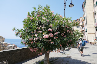
Back at Riomaggiore

Inverted and curved striations at Corniglia (View from trail earlier in the day)