Plan A for today was kayaking; still too windy. Plan B was hiking Ma'unga Terevaka, the highest point on Rapa Nui at 1,664 feet. I thought I had organized this hike until I realized the tour (the National Park requires a local guide) was on horseback, not by foot. Being terribly allergic to horses (1), it was on to Plan C: a tour of the cultural sites in the southwest of Rapa Nui.
Zoe, the same guide from yesterday, came to get me. We had a full tour today with the English couple from yesterday, plus three Brazilians, and two young women from Ireland and England. Oroŋo (2) the cliffside point on the southwest tip of the Island was closed due to high winds and surf.
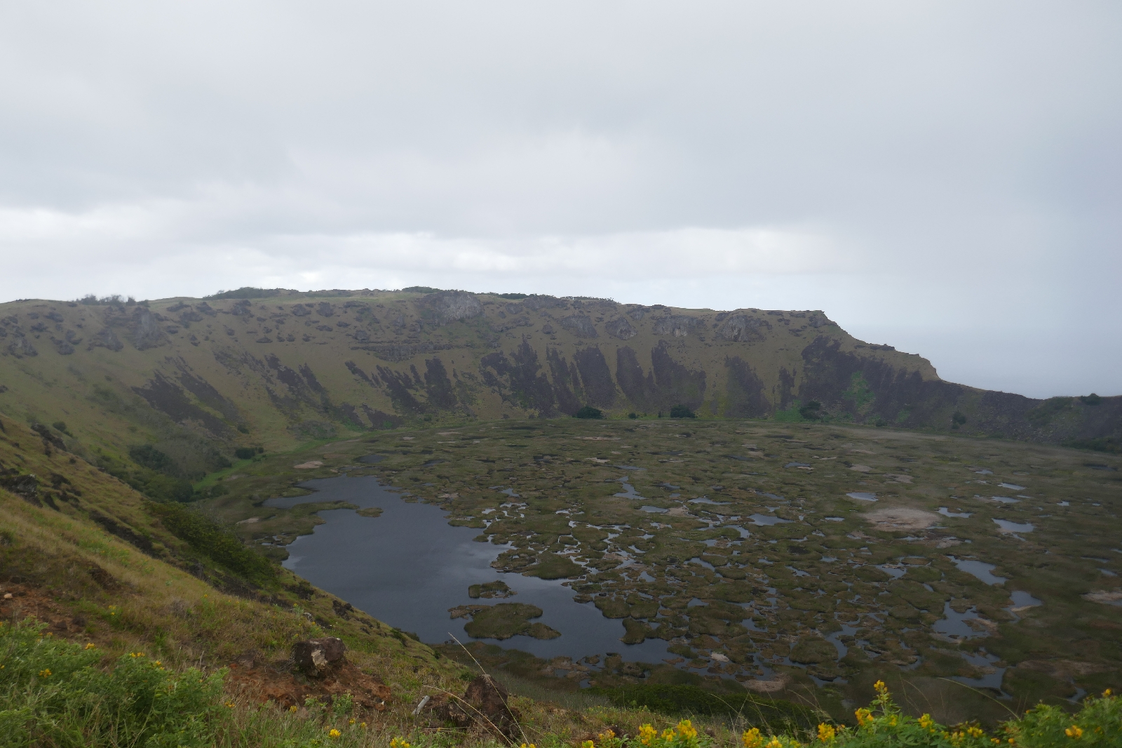
After the tribal wars of the 1600s, the islanders decided to hold a competition, selecting one man from each tribe. Their task was to climb down the cliffs at Oroŋo, paddle out on boards made of reeds, climb the islet, retrieve an egg from the nesting sooty terns, return to the mainland, and climb back up the cliff. The tribe of the first man to do so withput breaking the egg would rule the island for the coming year. The winning man would live in a cave for a year to whiten his skin, after which he could select a virgin (who had also lived in a cave to whiten their skin) as his wife. A nearby volcanic crater called Rano Kau contains most of the Island's fish water supply, and is dotted with reed islands.
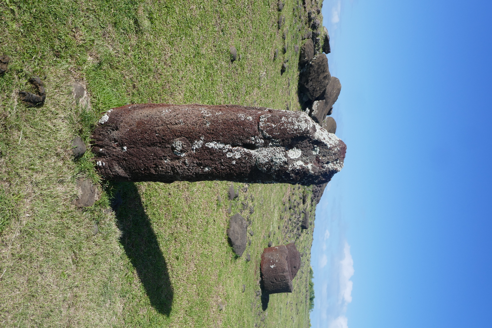
Nearby lies the best preserved Ahu at Vinapú. The similarities between these Ahu and Incan construction led some archeologists to speculate on cross-cultural contacts, but no other evidence for this hypothesis has been found.
Near Hango Roa, Ahu Akivi is the only accessible Ahu not at the seaside (3).
The final stop was for a hike and some cave exploration at Ana Te Pahu. Lava tube caves honeycomb the island. According to Thor Heyerdahl, many island families had secret caves in which family treasures (e.g., old stone carvings) were hidden. While unable to hike much on this trip, I was glad I had my hiking boots to tred on the uneven, slippery ground (and some puddles) in the caves.
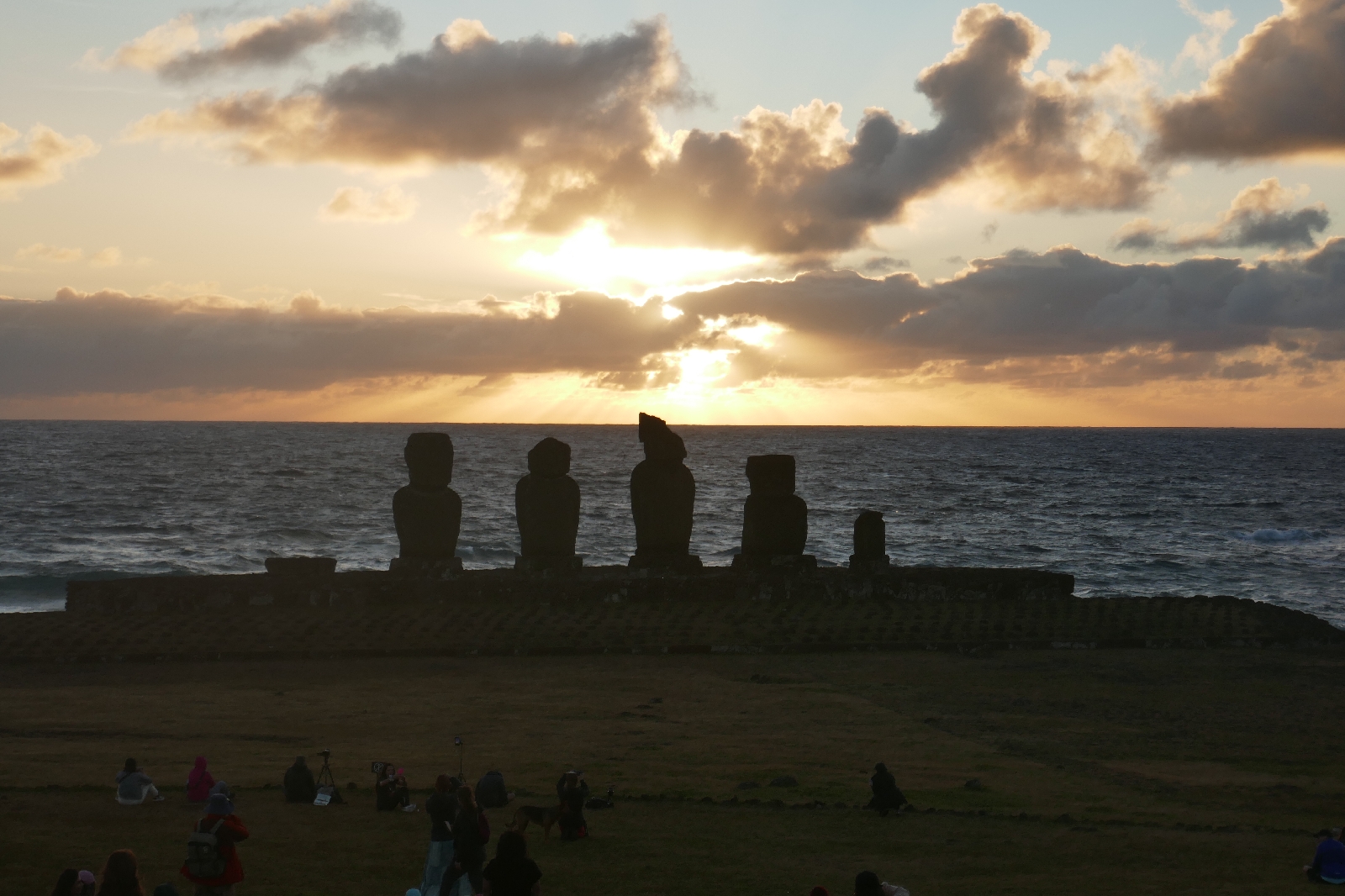
After the tour, many people gathered at Ahu Ko Te Riku to watch the sunset.
(1) After a horse ride about 10 years ago, my eyes were so swollen, I could barely see for the rest of the day.
(2) I had never seen the letter ŋ before. It is pronounced like ng, so orongo was the place name.
(3) There are others on private land outside the National Park.

 Horses roaming the hillside above Vinapú
 Alva, on the tour from Ireland, said the view from Vinapú was like the coast of County Clare in Ireland. I've been to the coast of Clare (my father lived in Clare as a boy), and the view is similar.
 Of interest to no-one but myself: a mid-channel marker to guide the oil tankers into port at Vinapú. Another marker is lower on the slope; line them up and your vessel is mid-channel.

The Rano Kau crater, source of most of the Island's fresh water
At Ahu Vinapú:

The best-preserved Ahu on the island

Toppled moai
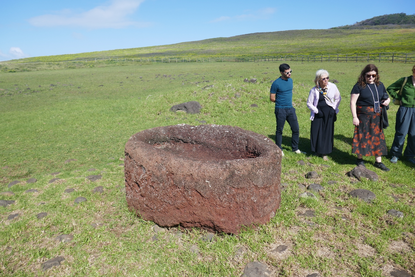
Innovation in top knot design: inset to fit more securely on Moai's head


Moai not on the seashore, reflecting the tribe's lower status


No comments:
Post a Comment